Doc Susie
Ute Bill Thompson

Arrow or Arrowhead

.

Articles to Browse

Topic: Regions

The Troublesome

Tradition holds that an army party led by one Lt. Col Johns gave the name of Troublesome to what had sometimes been called Oties Creek.  The Army was plotting a road in 1865 and had to go north to the forks of the East and West Troublesome in order to cross it, because of the soft soil, thereby being a “troublesome” creek.  Some historians claim that mountain man “Colorado Charley” Utter had built a cabin on the creek in 1861, which became a popular stopping place for early hunters and trappers in the region.  Another report credits John S. Jones of Empire with a cabin near the mouth of the Blue River, a few miles away, that same year.

Among the earliest settlers on the Troublesome were Barney Day, Henry King and Martin “Dock” McQueary, who had a cabin there in 1871.  In 1878, a post office was established at the King home. 

By the end of the century, many ranches had been established at on Troublesome Creek.  Farthest upstream was the remote George Hendricks ranch, difficult to reach year round and totally cut off from the rest of the world during winter snow.  Mrs. Hendricks had a large library and gave her children a sound education prior to their high school years in Kremmling. 

Among the most prominent ranches were those of George and Forrest Wheatly.  Probably the largest ranch (3000 acres) was that of the family of Con Ritschard, lying just north of current day U.S. Highway 40 east of Troublesome Creek.

Life was hard for the settlers in the area.  Like much of Grand County, the soil was frozen as deep as eight feet in the winter.  One memoir noted that when there was a death in the winter, the corpse was placed in the roof of a cabin, well swathed, until the spring thaw allowed for permanent burial.

There was a six year school (second to seventh grade) and a post office established at Pearmont about half way up the Troublesome, in the 1920s.  This area was named for local settler Gus Pearson.

Ranching was not the only pursuit along the Troublesome Creek.  Settler Roy Polhamos grew lettuce and shipped it through the Granby Cooperative to Denver.  He also had a potato contract with one of the Denver grocers.  Other growers contributed to the 125 refrigerated train carloads of lettuce that were shipped from Granby in 1924.  By 1929, 34 farmed from Granby to Troublesome netted $46,000, a highly respectable profit in those days.

Topic: Skiing

Skiing

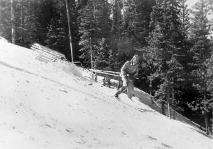
Grand County was one of the first areas in Colorado to enjoy sport skiing.  While mail carriers, loggers and other workers used the "Norwegian Snowshoes" as necessary winter transportation, it was a natural progression to begin racing down the slopes for fun.

An 1883 newspaper noted that in Grand Lake "Coasting on snowshoes has taken the place of dancing parties.   Quite a number of ladies are becoming adept at the art.  First class snowshoers, B.W. Tower and Max James are the best; or at least they can fall more gracefully then the rest".

According to famous Hot Sulphur Springs champion Barney McLean, that town had three jumping hills in the 1920s and held the first Winter Carnival in the West there in 1911.  By 1925, Denver sent special "snow trains" there for the recreating tourists.  Skiers such as Bob McQueary and Jim Harsh competed in statewide events along with skiing "veterans" Horace Button and McLean.  Grand Lake's Jim Harsh became the first Coloradoan to qualify for the U.S. Olympic Team.

In 1932, the Grand Lake Ski Club held its first winter sports week on Denver 25-January 1st.  Featured was a motor sled with an airplane engine which pulled skiers over the frozen lake are speeds of 90 miles per hour.

Colorado's first ski tow was opened at the summit of Berthoud Pass in 1936.  Berthoud Pass operated on and off throughout the next 60+ years but was finally closed and the lifts dismantled in 2002.  

What became the resort of Winter Park featured skiing at the West Portal of the Moffatt Tunnel and the Winter Park Ski Area opened as a result of efforts by Denver Parks & Recreation Director George Cranmer. Early lodging resorts in the area, then known as Hideaway Park (now Winter Park), included Sportland Valley, Timberhaus Lodge, and Millers Idlewild Inn.  Eventually trains made daily runs to Winter Park, loaded with intrepid skiers.  Steve Bradley invented the first effective snow packer on the slopes of Winter Park.

With a strong record of winning high school ski teams, Grand County accounted for a remarkable number of skiers who later took park in FIS (International Federation of Skiers) meets and U.S. Olympic teams.

A later ski area, now know as Sol Vista Ski Basin (formerly Silver Creek Resort) opened in Granby in the 1980's.  World class cross country ski areas in Grand County include Snow Mountain Ranch and Devil's Thumb Ranch.

Topic: Time Line

Statehood

Colorado was the 38th state admitted to the Union, and is known as the “Centennial State” because of its entrance into the union in 1876, one hundred years after the signing of the Declaration of Independence. The Colorado River was named earlier, and is Spanish for “red“, the color of the water that the Spanish explorers observed.

People have been living in Colorado at least 9,000 years. Spanish explorers were here in 1540, but the discovery of gold caused a major population explosion in 1859.

The state consists of 3 topographic zones: plains, mountains, and plateaus. The Continental Divide bisects the state, north to south and there are 54 peaks above 14,000 feet.

Denver is the State Capitol at 5,280 feet, one mile above sea level. Colorado is noted for its waterways and is the only state in the U.S. from which all water courses flow out of the state. Rivers that have their origins in Colorado include the North Platte, South Platte, Arkansas, Rio Grande, and the Colorado with its headwaters in Grand County.

Rowley & Just Homesteads

Karl and Adella Just homesteaded on Pole Creek in the Fraser River Valley in 1896.  Della was the daughter of Henry Lehman, who had, himself, homesteaded on the upper Grand River about 1880.  Karl and Della worked hard, adding to their property until by the late twenties, they had the largest holding in the valley. 

This lovely ranch was where Snow Mountain Ranch is now, and their log home still stands there even today.  Their several children homesteaded in their own rights.  Della and her son Alfred had what is known as the Rowley homestead, (now part of the Y-Camp) as well as what currently is the Winter Park Highlands.  Son Rudy and his wife Clarabelle ranched part of the original Just property on Pole Creek where they watched over his mother.  Another daughter married one of the Daxton boys and their spread was on Crooked Creek.

Until the 1950's, just beyond Tabernash on the north side of the highway at the foot of Winter Park Highlands stood one of the original log homes of this family. In fact, this house appeared in a 1952 movie called "On Dangerous Ground", starring Ida Lupino, Robert Ryan, and Ward Bond.  It was torn down some years later and a modern house built there.

Life was hard for ranching pioneers, perhaps hardest of all for the women, for they worked in the fields and of course, did all the work of the house as well as much of the garden work.  Little Della raked hay during the season, hoed gardens, hauled water, fished, sewed, and cooked.  She was tough.  The bright spots were when rare visitors stopped by, or as the population increased, dances were held in one town or another.

It was a given that the Just home, like those of most pioneers, had no indoor plumbing.  Nobody expected it and nobody complained.  However, by 1957, Della Just was in her nineties.  Karl was long gone.  Her children decided that she should have indoor plumbing after all these years, and they heard that young Dwight Miller had a brand new backhoe.   When they called, Dwight was pleased at the thought of doing such a useful job.

He brought his machine out to the ranch and prepared to get to work.  He discovered, however, that there was disagreement on this bright idea.  Della thought the notion was silly.  "I've lived all these years with an outhouse and I don't see any reason at all to change!"  

Back in those days, temperatures were very much colder than those currently expected.  Forty and fifty degrees below zero were not unusual at all.  But that old lady didn't mind this.  (No doubt, there were chamber pots available for the worst weather.)

Della's children, themselves no longer young, won out, and Dwight dug the trenches and the septic tank hole and laid the pipes.  We never heard whether Della got used to such luxury or not, but we know that Rudy and Clarabelle agreed that moving into the modern world was a good idea!


Topic: Regions

Church Park

George Henry Church and his brother John had a substantial ranch in Jefferson Country, prior to Colorado Statehood.  When the Timber and Stone Act of 1878 was passed, it permitted the purchase of land unfit for agriculture for $2.50 an acre.  Thus the Church brothers obtained land in Middle Park for summer grazing.  They would move their cattle into the Park by driving them over the Rollins Pass.   The area they used is just west of the town of Fraser and became known as Church Park.

In 1910, the Church Ditch was created to divert water across the Continental Divide for irrigation.  The remains of this early trans-mountain project can still be seen today at mile marker 241.5 on U.S. Highway 40.

Topic: Leisure Time

Leisure Time

Of all the leisure time activities available to the pioneers, dancing was the favorite. Dances were held in grand hotels that remained from the mining boom, such as the Fairview House and The Garrison House in Grand Lake. Quadrilles, a type of square dance, were popular at the time. A fiddler would provide the music and serve as the caller. These parties would start in the evening and last all night.

The formidable temperatures and great traveling distances were incentive for getting the most out of every gathering. Winter Sports have also always been a popular pastime. Skiing was introduced to the region during the winter of 1883. Snowshoeing and sleigh rides were also enjoyed. 1882 officially brought the arts to the Grand Lake area when the Dramatic Society was organized. A production of the well-known comedy "Our Boys" was the premiere performance.

John & Ida and the Sheriff Ranch

Sheriff Ranch lies in a valley just below Highway 40, 2 miles east of the Town of Hot Sulphur Springs. It's the serene world of John & Ida Sheriff. Old cabins with outhouses align themselves against the riverbank of the Colorado River. They tell a story of the fishermen who once rented the cabins for just a dollar a day-a long time ago.

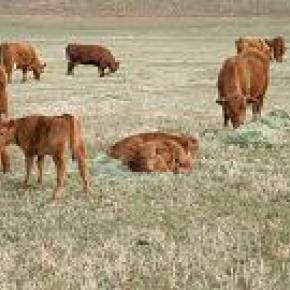
It's a quiet Sunday morning and only the sound of geese flying overhead can be heard. The cattle are quiet in the meadow as the sun begins to rise and feeding time comes close. They sense the presence of this stranger. The air is cool and damp as Ida comes to greet me. John is not far behind. Looking across the meadow, a calf seems to have caught herself in a fence and to my surprise, the entire herd rushed off to help her. Suddenly she's free and the cattle slow to a stop. The cows quiet down as John throws hay from the pickup. The calves are more curious and come right up to us. One mother cow took off with her young one and Ida called her by name, "Oh, Spook, why are you running off?-she's always taking off! She's afraid you're here to brand her!"

John & Ida begin this morning just as they have for the past 57 years, checking on momma cows ready to give birth and carefully watching the newborn calves. They all have a name, just like children. Two calves, not quite awake, lie together on the hay while chewing on the tender hay. The sound of the cows chewing is soothing to the ear.

A story of the ranch heritage unfolds while we sit at the kitchen table enjoying a cup of tea and fresh baked date-nut bread.

Marietta Sumner Sheriff and her sons came to Leadville, Colorado from a farm in Keithsburg, Illinois, in search of mining claims recorded by her deceased husband, Matthew. (Many farmers and ranchers moved to Colorado ? the promise land of gold). Some years later, Marietta and her sons moved to Hot Sulphur Springs where her sister, Mrs. William Byers lived (1859 Rocky Mountain News founder, William F. Byers).

The ranch has been passed down from generation to generation since then. John Sheriff was the eldest son of Glenn and Adaline Sheriff (Glenn Sheriff was County Commissioner for 21 years, County Assessor, Director of the State Welfare Board for 13 years, and President of the Board of the Middle Park Union High School). He attended the Hot Sulphur Springs Public School through the 12 th grade. Everyone had to share in working the ranch and John was no stranger to peddling milk door to door for 10 cents a quart before he went to school.

Harsh winters closed off travel over Corona Pass (Top of the World) and the only way into the County was on snowshoes. Middle Park was a tough place to live with 50 degrees below freezing for weeks on end. Many people stocked up on flour and sugar and other supplies for the winter because they couldn't get into town for supplies. The Sheriffs were more fortunate and would use a horse and sled and follow the river into the town of Hot Sulphur for supplies.

Ranch life was not a wealthy profession as many may have thought. The Sheriffs know how hard it was to keep the family ranch. In the 1930's, Roosevelt's New Deal (Agriculture Adjustment Administration-AAA) forced ranchers and farmers to kill off half of their herd to level out the economy. Cow hides were sold for 5 cents a hide. Ida recalls, "Everyone in agriculture had to start over. Everyone was in the same boat. Some people couldn't take the stress and just moved off their ranches-- just leaving them!" The Sheriff ranch was in debt following the depression era. Ranches were up for foreclosure everywhere; banks didn't want them. The family just hung in there until they could get a herd of cattle going again.

Joining the Navy, John served in the South Pacific during World War II, and returned home to attend Colorado State University where he studied general agriculture. He met and married Ida Marte in 1949, daughter to early Grand County pioneers, Liberat and Bertha Marte. Ida is known over the years for her involvement with historical societies, documenting the history of the County, and maintaining original cemetery plots for the Hot Sulphur Springs Cemetery.

The years after the war were a struggle. With not enough hay to put up and only a handful of cattle, ranchers turned to raising sheep and harvesting crops of lettuce. Japanese prisoners of war were sent here from California to work on ranches.

"We always had to have an outside income ?cabin rentals, John's dad, Glenn was commissioner, and Mom worked at the library to help pay expenses. Once in a while we would have enough cows or lambs to go to market. The Federal Land Bank saved a lot of ranches allowing us to borrow money to get going. We were all afraid of another recession after the war," Ida said.

In the first 30 years of their marriage, John & Ida did not see much of each other. John traveled back and forth taking cattle to auction. When they got married, the ranch was so much in debt that they were "darn lucky that we didn't loose it".

The Sheriff homestead was registered in 1881 with 1350 acres and had as many as 250 head of high grade Herefords by 1975. Pure-bred bulls were purchased from neighboring ranches (Taussig Brothers, Hermosa Ranch, and Lawson Ranch) improving the quality of the herd. Sheriff ranch's registered brand-Bar Double S---is still known to be the oldest registered brand in the County.

In 1984 a large portion of ranch acreage was sold to Chimney Rock Ranch Company and the remaining acreage is where Ida and John live today, raising a small herd of cattle. They no longer make trips to auction. Today, a buyer comes to the ranch.

With no electricity in the early years, trudging through deep snow to the barn's generator was a morning ritual to power the lights in the house. In later years, electricity allowed the Sheriffs to start the generator with a flick of the switch from within the main residence.

The years of struggle and hardship, hard work and the desire to keep the family ranch has been a great sense of pride for the Sheriff family today. John and Ida, their ancestors and their family are a living example of family ranches surviving today. Not many remain, but this ranch, with a great family history, has a river of life flowing through it.

Topic: Railroads

Moffat Road


"I shall never forget it as long as I live. Nor do I ever expect to experience anything comparable to it again. Civilization had found its way across the mountains into Middle Park," reflected Mrs. Josephine Button in 1955 on her 91st birthday, as she recalled seeing smoke from the first Denver Northwestern and Pacific work-train on Rollins Pass, high above the Fraser Valley and Middle Park. Once those rails made it over the Continental Divide all the way to Hot Sulphur Springs, "changes came thick and fast." Many men, many dollars, many routes and many dreams tried to bring a railroad over the Continental Divide into Northwest Colorado, and the "Hill Route" over Rollins Pass that finally accomplished it a century ago has retained its allure ever since.

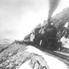
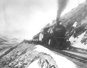
The Moffat Railroad built a cafeteria, telegraph station, living quarters for Moffat's "Hill Men" (as the railroad crews up there were known) and a fine hotel - all collectively called Corona Station. Soot-filled snow sheds protected over a mile of this windblown section of track. And where today silence is the most powerful sense, colorful locomotives pulled passenger and freight cars, filling the rare atmosphere with black smoke and mechanical clatter.

Decades of men's dreams lay behind the once massive snow shed that cut the bitter winds from the north and west, behind that fine hotel that offered some of the most spectacular scenery in America, behind the hopeful Town of Arrow nestled below tree-line ten or twelve miles west of Rollins Pass, and behind that first work-train that Josephine Button watched from her hay ranch along the Cottonwood Pass Wagon Road to Hot Sulphur Springs. Competent, often powerful, men in the 1860's through the 1890's filed surveys, graded road beds, and even began drilling before being stopped by severe storms that foiled the best laid plans or their inability to fund the ambitious projects.

Dreams to penetrate the high mountains along the Divide in central Colorado began when the Front Range was flooded with miners during the Gold Rush of 1859. Even before Colorado became a territory in 1861, Golden City, just west of Denver along Clear Creek, recognized its potential as a gateway to the rich mineral resources of mountain towns like Central City, Black Hawk, and Georgetown. Golden City's ambitions went beyond becoming a mountain transportation hub, believing that with the right incentives, enthusiasms, and leadership, its location supported a future as a national commerce center. 

Golden City certainly had men of vision, ambition, and wealth among its ranks. William Loveland and George Vest, both young and feverishly ambitious to see Golden City reach its potential, vigorously pursued their dreams for a powerful commercial center in Golden City. From Missouri River towns like Leavenworth in Eastern Kansas, leading town founders also recognized the benefits of linking their water and rail routes to the east with the resources of the west. Finally, as if destiny had demanded it, Edward L. Berthoud, a young civil engineer and surveyor with energy and ability, arrived in Golden City from Leavenworth in April of 1860 to unite the similar passions of leading citizens from both locations.

From 1861 until 1866, Berthoud, Loveland and Vest focused on bringing a direct transcontinental railroad route through Golden City. First, Edward Berthoud, along with Jim Bridger and a capable young cartographer named Redwood Fisher, blazed a trail across Berthoud Pass through Middle Park all the way to Salt Lake City. Returning to Golden City on May 28, 1861, Berthoud reported "a good wagon road could be ?quickly' built" from Denver to Salt Lake City over Berthoud Pass for about $100,000.00. According to the local hyperbole, a railroad would surely follow.

In spite of considerable enthusiasm, disappointment plagued early efforts to put a rail line over the mountains in Colorado Territory. In 1862, Territorial Governor John Evans sent the Surveyor General for Colorado and Territories along Berthoud's route and others to confirm or deny the potential of a railroad line. About the same time, the Union Pacific Railroad Company sent an independent reconnaissance to examine potential routes over the divide that included Berthoud and Boulder Passes (Boulder Pass became Rollins Pass in the early 1870's, when John Quincy Adams Rollins built a toll road over it, and then Corona Pass when the Railroad crossed it). Surveyor General Case and the UP agreed that neither route offered much hope for a standard gauge railroad. The dream of a transcontinental line over the Continental Divide through central Colorado seemed to die with the UP surveyor's words, "I learned enough to satisfy myself that no railroad would - at least in our day - cross the mountains south of the Cache la Poudre..." 

Multiple failed attempts to bring a rail line over the Divide through Middle Park during the following decades strengthened the UP's "death sentence." Against the odds, Berthoud and Loveland continued to solicit support for a railroad west over or through the Continental Divide, using improved surveys and maps to support their requests. In the 1880's, survey crews from a variety of railway incorporations were scattered over the high country on or near Rollins Pass. Over Berthoud, Rollins and other passes, they marked potential railroad lines with their wooden stakes. It was during this stretch of strenuous surveying activity that David Moffat, a highly successful Denver capitalist, got involved with an unsuccessful effort to bring through the mountains instead of over the top. 

 In the early 1880's, Mr. Moffat invested in the Denver, Utah and Pacific Railroad, which intended to tunnel through the mountains near Rollins Pass. Like the other efforts, though, the Denver, Utah and Pacific vanished in a few short years. Unlike many other lines that accomplished little more than surveys and maps, the DU&PRR completed significant grading and began tunneling before reaching the "end of its resources."

Money, power and success supported Moffat's dream to put Denver on a direct transcontinental railroad line. Doctor Robert C. Black, III, wrote that David Moffat's failed efforts in the early 1880's converted him to the idea that Denver needed to be on a direct transcontinental rail line. Moffat considered the route over Rollins Pass valuable enough to have surveying and grading crews working on it throughout the winter in 1902. The Denver Rocky Mountain News claimed that Moffat's route through Northwestern Colorado included "the largest strip of fertile land as yet undeveloped in the United States..." With his Denver, Northwestern and Pacific Railroad, David Moffat planned to make good his intentions to put Denver on direct transcontinental railroad line.

Moffat's original plan called for the "Hill Route" over Corona Pass ? the name changed from Rollins Pass in honor of Corona Station at the top ? to last for only a few short years. While the "temporary" route over the top generated resources by extracting the resources of Northwestern Colorado, a tunnel was to be bored through the Continental Divide. Even the wealth and power of Moffat, though, failed to adequately finance the tunnel before he died in 1911. The temporary line, therefore, lasted for nearly of a quarter century, from 1904 until 1928.

Its obstacles proved as enormous as the mountains it crossed. Work crews had to cease operations because of snow for most of April in 1920. The road was closed from late January until May in 1921. In December of 1924, engine number 210 busted "a main reservoir pipe," causing the train to fly down the hill out of control until it jumped the tracks and crashed into the valley below. Clearly, the Denver and Salt Lake Railroad, which took over Moffat's DNW&P after his death, needed a tunnel to replace the expensive effort over the "Devil's Backbone."

 As Denver and Salt Lake Locomotive Number 120 came through the tunnel in early 1928, it represented the culmination of a massive undertaking through wet, unstable rocks which required considerable engineering ingenuity and caused six deaths in a 1926 cave-in. It also took an enormous amount of coordination and effort to secure the necessary funding. Through local bond issues, private investors and other means, the project was completed. And through a connection at Dotsero, a railroad station less than 30 minutes west of Vail on I-70, freight and passengers could make a direct Pacific connection from Denver. Posthumously, David Moffat's dream became a reality.

For significant periods of time since the trains stopped operations over Rollins Pass in the late 1920's with the opening of the Moffat Tunnel, on-road vehicles crept along its relatively easy grades and wide curves from Rollinsville on the east slope to Winter Park on the west side of the Divide. Like now, the road ran through an area attractive to backcountry campers and sport enthusiasts. On September 1, 1956, local officials and private citizens met on Rollins Pass to celebrate a "joint state-federal-county project to convert the old D. & S. L. railroad right of way over Corona Pass into an access road for sportsmen." According to the Denver Post, the game and fish department's construction division reconstructed the road during the summer of 1955 for about $20,000. The following year, the road became a scenic route over the Continental Divide for family cars and jeep caravans alike. And after it was built, or at least reconstructed, they did come. Intrepid tourists into Middle Park.

Topic: Biographies

John Charles Fremont

Captain John Charles Fremont was born in 1813 and at the age of 31, in June 1844, was exploring the northern reaches of the Republic of Texas when he passed through Grand County.  This marked the first appearance of official government enterprise in Grand County.

His expedition included some 40 explorers, including people of Creole, French, and Black descent. The guides were Thomas Fitzpatrick and Kit Carson. This expedition entered Grand County via Muddy Pass and exited via the Blue River, never traveling into the eastern part of the County. 

They met with some 200 Arapahoe Indians, who were traditionally suspicious of the intruders, but through the giving of trade gifts, overt conflicts were avoided. The cartographer for that expedition was Charles Preuss, who provided the first map on which all of the central Rocky Mountain Parks were named and mapped accurately.

Topic: Mining
Mount Baker

Gaskill and the Wolverine and Ruby Mines

Mount Baker

The Wolverine Mine was discovered in 1875 by James Bourn and Alexander Campbell. Bourn was the brother-in-law of James Crawford, the founder of Steamboat Springs. James Bourn was the twin brother of Crawford's wife, Maggie.  A Grand County recording error forever changed the name of Bourn in the area to "Bowen".  The mine was located in the Rabbit Ears Range on Bowen Mountain, up Bowen Gulch, approximately 10 miles northwest of Grand Lake.  This discovery sparked additional exploration in the area that lead to a number of new mines. Within a week of the original discovery,  interested parties formed the Campbell Mining District which included Bowen Mountain, Bowen and Baker gulches.  Some of the Middle Park residents who participated in the mining exploration  were John Baker, Charles Royer, Charles Hook, John Stokes and the Redman brothers, William and Mann. The Redman's  eventually  discovered the Sedalia mine. Bourn and Campbell  in less than a year lost the Wolverine mine by not fulfilling a grubstake agreement with the Georgetown grocers, Spruance and Hutchinson.

John Stokes leased the Wolverine Mine from the grocers until Edward Phillip Weber, an agent representing a group of Illinois investors, purchased the Wolverine Mine in the Summer of 1879.  Weber continued purchasing other Campbell Mining District claims which created a great deal of local excitement.  Weber hired Stokes  to assist him and also hired Lewis Dewitt Clinton Gaskill to act as the first foreman for the Wolverine mine.  Gaskill had mine operation experience, having successfully operated the Saco Mine, on Leavenworth Mountain, above Georgetown for several years.  A mining camp was built  below the Wolverine Mine that contained a large bunk house building and a more substantial mine office building.

Gaskill, a Civil War veteran of the 28th  Regiment of the New York Volunteer Infantry,  had come to Colorado in 1868 as a representative of a group of Auburn, New York bankers to invest in mining properties.  He eventually successfully operated the Saco mine in 1873 and 1874.  He invested in the Georgetown, Empire and Middle Park Wagon Road in 1874, which was a toll road that finally made the Berthoud Pass road passable for wagon traffic.  Gaskill also acted as the foreman during the construction of the road. The principal investor in the road was William Cushman of the First National Bank of Georgetown. The bank had a financial collapse in 1877.  At that time, Gaskill was the secretary of the road company and lived with his family in the company house just below the summit of Berthoud Pass on the west side.  William Hamill, a wealthy Georgetown businessman, bought the wagon road in a foreclosure auction in 1881 for $7,000.  Gaskill continued to live with his family in the Berthoud Pass summit house until 1885, when he moved his family into the Fraser Valley and homesteaded 160 acres along Elk Creek.

The settlement of Gaskill began when  in August of 1880,  Al J. Warner built a log cabin store in a meadow below Bowen Gulch on the trail/road that lead to both Bowen Gulch and Baker Gulch.  The settlement was also strategically well placed midway on the trail/road between Grand Lake and Lulu City and the Lead Mountain Mining District.  Another store was built in September by  John K. Mowery.  By that October, Mowery was appointed as the first postmaster of Gaskill.  The following spring E. Snell, opened a large general merchandise store that prompted the original store keeper, Al Warner, to relocate to Grand Lake as Al's Place. The town was named to honor L.D.C. Gaskill, the greatly respected foreman of the Wolverine Mine, the road builder/operator and the Civil War veteran.  By 1882, the town covered 60 acres.  E.P. Weber of the Grand Lake Mining and Smelting Company got involved in the town real estate development by laying out a city grid and offering lots for sale.  Weber's plat renamed the town Auburn after L. D. C. Gaskill's home town of Auburn, New York, but the Gaskill name stuck.  By the close of 1882, there were over 100 residents living in Gaskill.  The most substantial building was the Rogerson House, a well appointed two  story, squared log hostelry, Horatio Bailey Rogerson, proprietor.  Rogerson, would be elected County Commissioner in November of 1882, but would not serve because of a sudden discovery of ineligibility.  Instead, lame duck Colorado Governor Pitkin, appointed E. P. Weber to the post.  Weber was killed in the infamous July 4, 1883 shoot-out at Grand Lake.   

The Bowen Gulch trail lead to many of the  most productive and worked mines in the Campbell Mining District which included the Wolverine, now owned by the Grand Lake Mining and Smelting Company, E. P. Weber superintendent and the Ruby and Cross mines owned by Kentucky and Colorado Mining and Smelting  Company, John Barbee superintendent. Barbee, who lived in Grand Lake,  would go on to serve as superintendent of schools, Justice of the Peace and briefly the editor of the Grand Lake Prospector.  Barbee's partner in many endeavors was Antelope Jack Warren. Warren was as rough as Barbee was refined.  He acted as a foreman and, by one account, a bodyguard for Barbee.  The Bowen Gulch trail continued up the mountain to Bowen Pass and then descended into North Park and the Jack and Park mining districts which were organized by the end of 1880, to the settlement of Teller City.  Passable roads that could handle wagon traffic were needed and often planned but rarely built.  The high cost of building and maintaining  wagon capable roads in Middle Park was a difficult proposition for local governments and private entrepreneurs.  

The Grand County Commissioners in July of 1877 had declared the trail from Grand Lake to the mining gulches of the Rabbit Ears  Range to be a county road.  However there was little county money to pay for improvements to make the trail a road.  Private investors were reluctant to invest in wagon roads when there was the persistent  rumor that railroads were coming spawned by the numerous railroad surveys that were performed in the area.   Albert Selak, a Georgetown brewer, in August of 1878, organized a toll road that would branch off of the Georgetown, Empire, and Middle Park Wagon Road at the Ostrander Ranch on Red Dirt Hill, and proceed to Grand Lake and continue on to the Rabbit Ears Range mines and continue on into North Park and on to the Wyoming territory line.  John Barbee invested in the Middle Park Toll Bridge Company, a toll bridge company that intended  to build a bridge across the Grand River  above the confluence of Willow Creek and the Grand River.  However, this project languished, and was taken over by the county with an expenditure of $150.  

If ore wagons would need to haul ore to the nearest reduction mill which was over 60 miles in Georgetown, the toll road might have been a financial success. However, the lower grade ore from these Rabbit Ears Range mines would not yield a sufficient profit to cover the transportation and processing costs in a market where the market value of silver annually declined.  So the ore piles grew.  What was needed was a nearby reduction mill or cheaper transportation, like a railroad or a higher price for silver.  Weber had  repeatedly promised that a reduction mill was coming, but nothing was ever built.  By April of 1883 with tons of ore piled up and waiting for transport to be processed,  Weber temporarily closed the Wolverine Mine and laid off his miners.  He admitted  in June of 1883 that the ore from the Wolverine was “rather refractory” and that it would not justify shipment without local reduction.  Some hoped the closing was a strategic move by Weber to trigger a sell off of area mining properties  so that he could acquire additional mines before he built the reduction mill, but it was not to be. Weber would soon be shot dead by his political rival, John Gillis Mills.

The favorable newspaper stories of Rabbit Ears Range mining would continue, but for the informed, it had become  clear that without a major investment in improved transportation including a railroad or a major investment in a reduction mill in the area, the mining concerns were doomed to fail.  Mining claims had to be worked in order to be kept.   A minimum of $100 of labor or $500 in improvements had to be expended each year to maintain the claim or else the claim would be deemed abandoned.  Many claim holders leased their claims to miners to work for a percentage of the return.  Without the ability to sell and process the ore for a profit, there was no return.  The speculative mining investment money began to dry up and the miners and their supporting merchants began to leave.  By the end of 1886, the Middle Park mining boom had  ended. To further add to the decline,  a border dispute that arose between Larimer County and Grand County over the taxation and mineral wealth of North Park was finally decided in 1886 by the Colorado Supreme Court in favor of Larimer County.  North Park was part of Larimer County, not part of Grand County.  A lawsuit would follow so that Larimer County could recover the wrongly collected taxes of $20,000 from Grand County.  Grand County's total tax income at the time was less than $3,500 a year.

Error message

  • Notice: Undefined index: quantity in omega_views_mini_pager() (line 234 of /var/www/html/docroot/sites/all/themes/omega/omega/inc/theme.inc).
  • Notice: Undefined index: quantity in omega_views_mini_pager() (line 234 of /var/www/html/docroot/sites/all/themes/omega/omega/inc/theme.inc).

Arrow or Arrowhead